Sea to Sky Country
coolest map ever
Wanna peakAview?
Place your order now!
-
The Area
Wanna experience a perspective only seen from scenic flights and squirrel suits?
Get oriented with peakAview!
-
The Map
The peakAview Sea to Sky Country raised relief map gives you a birds eye view of the coolest coastal mountain range in the world.You can hold it in your hands and marvel at it for hours looking at the places you have been or would like to go. The map is made from recycled plastic/ PET bottles in the US and Canada.
-
The Map
The expansive Whistler Blackcomb backcountry is modeled in great detail. Check out glaciers, chutes, couloirs, rivers and lakes!
Get oriented with peakAview!
WHAT OUR CLIENTS SAY ABOUT US
![]()
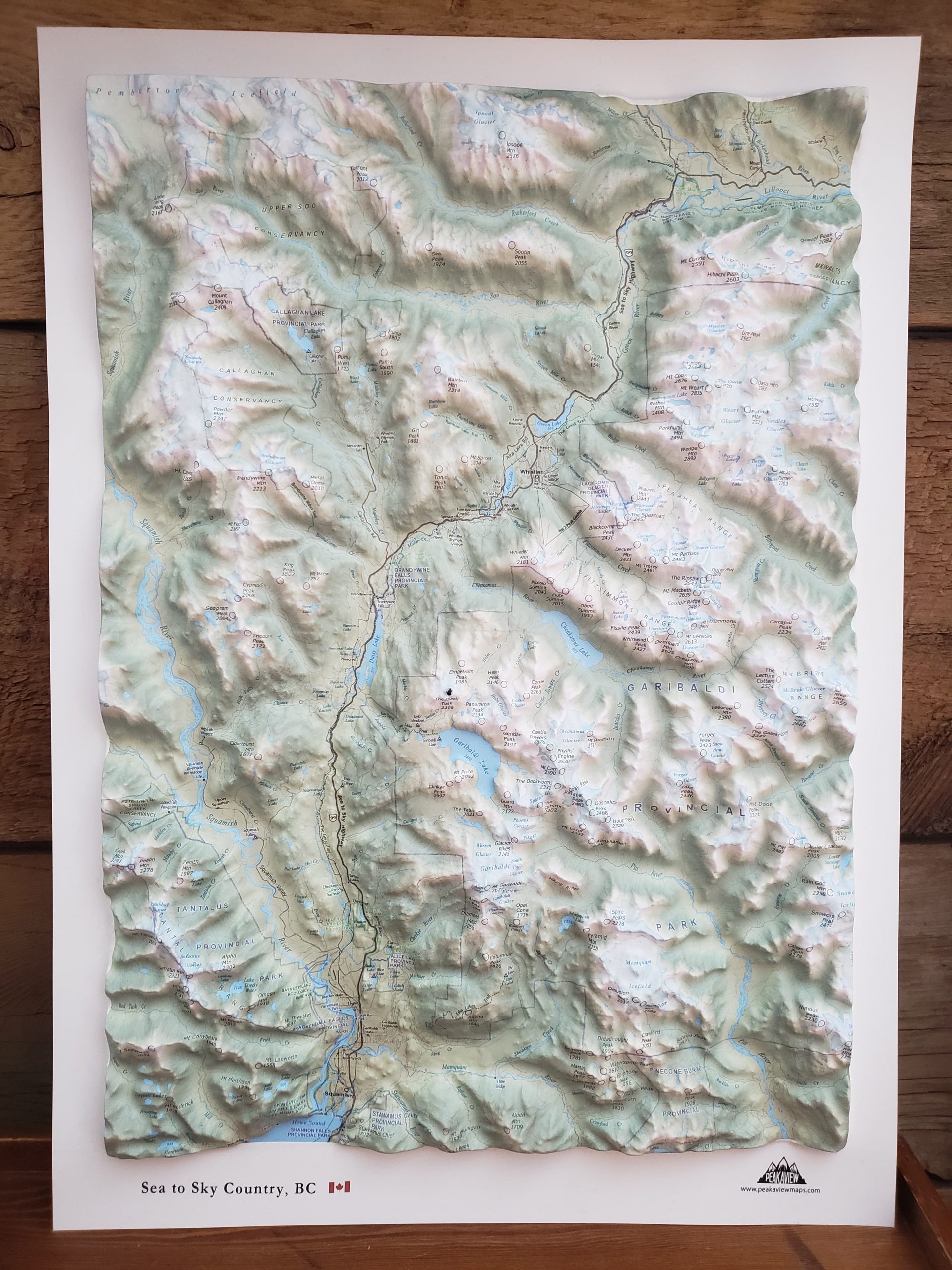
The Sea to Sky Country map is a stunning blend of technical detail and artistic craft that perfectly captures the rugged soul of the Coast Mountains. It’s more than just a map; it’s a high-quality centerpiece that any topography lover would be proud to display.
Outdoor Magazine
![]()
It is such a detailed and precise representation of the local mountains, very cool.
Brendon G. Vancouver BC
![]()
It's such a great project. We couldn't decide whether to frame it or not so we got 2 and framed one!
Blake Whistler
![]()
I love my Sea to Sky Country map! It's such a great reference tool, I could look at it all day!
Kathy T Seattle WA


